At a glance
Upputhara Panchayat at a Glance
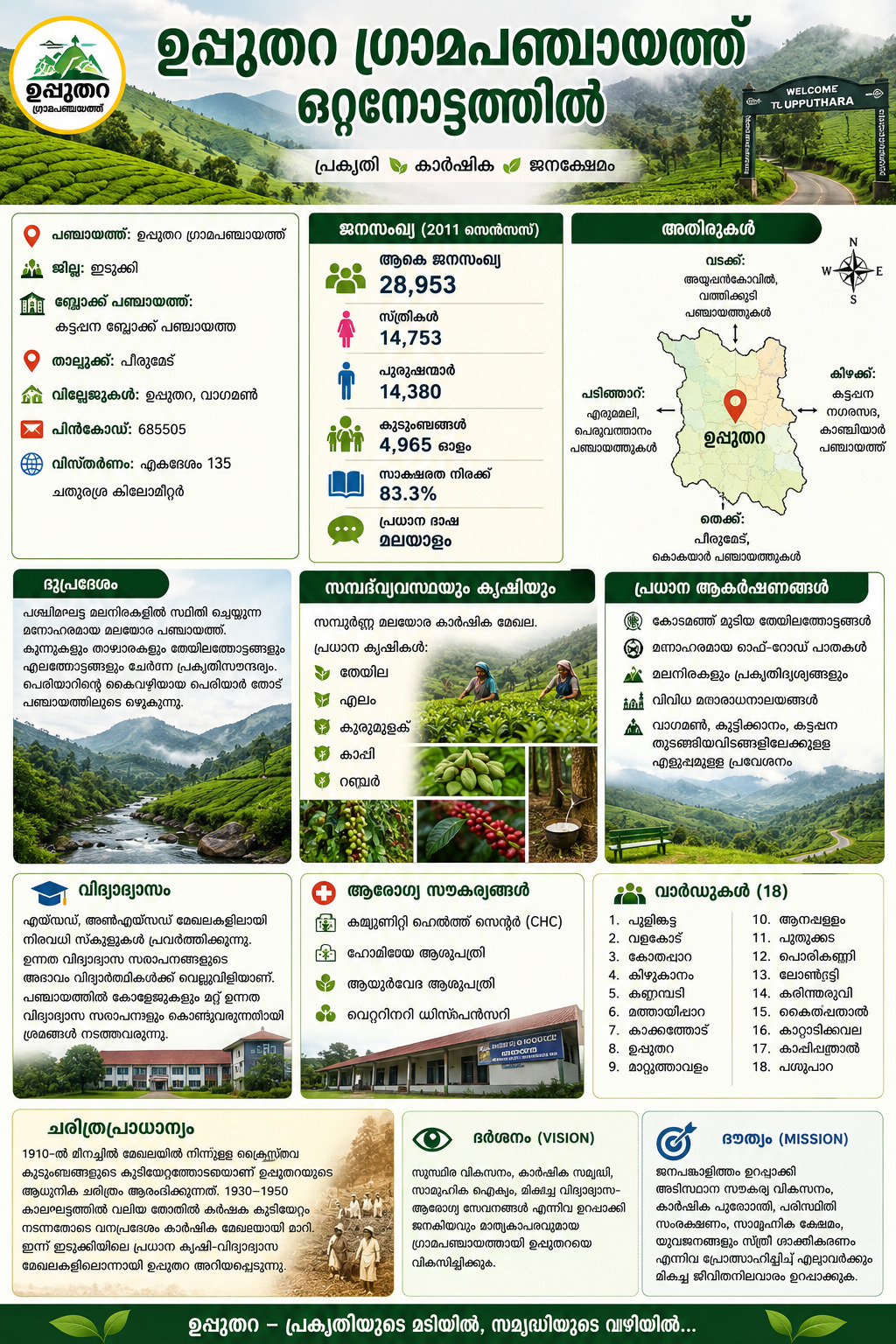
📍 Panchayat: Upputhara Grama Panchayat
🏞️ District: Idukki
🏛️ Block Panchayat: Kattappana Block Panchayat
🏘️ Villages: Upputhara, Vagamon
📌 Taluk: Peerumade
📮 PIN Code: 685505
🌐 Area: Approximately 135 square kilometres
👥 Population (2011 Census): 28,953 Women: 14,753 Men: 14,380
🏠 Households: Around 4,965
📚 Literacy Rate: Approximately 83.3%
🗣️ Main Language: Malayalam
🌄 Terrain: A hilly region located in the Western Ghats mountain range
Boundaries
East: Kattappana Municipality, Kanchiyar Panchayat
West: Erumeli, Peruvanthanam Panchayats
South: Peerumade, Kokkayar Panchayats
North: Ayyappankovil, Vathikudy Panchayats
Geography and Economy
Natural Beauty: Upputhara’s landscape is filled with hills, mountain ranges, and plantations. The Periyar Thodu, a tributary of the Periyar River, flows through this panchayat.
Agriculture: This is a fully highland agricultural village. Tea, cardamom, pepper, coffee, and rubber are the main crops here. Several major tea estates are also located here.
Main Attractions / Pilgrimage Centres
Though not heavily commercialised, the peaceful atmosphere, mist-covered tea plantations, and off-road paths are the main attractions here.
Vagamon, Kuttikkanam, and Kattappana are popular destinations easily reachable from Upputhara.
Various Hindu, Christian, and Muslim places of worship coexist here in harmony. Many historically significant temples are also included among them.
🌊 Bordering Features: Periyar River to the east, Meenmutty waterbody to the west, Kakkatodu protected forest area to the north, and the Chinnar–Karintharuvi region to the south
🌱 Main Crops: Tea, pepper, cardamom, coffee, rubber
🏫 Main Educational Institutions: There are many schools functioning in aided and unaided sectors in this panchayat. However, the absence of higher education institutions in the panchayat is pulling students backward in the field of higher education. The governing bodies are committed to bringing higher education institutions to the panchayat.
🏥 Health Facilities: Community Health Centre (CHC), Homoeopathy Hospital, Ayurveda Hospital, Veterinary Dispensary
🗳️ Number of Wards: 18 wards
Pulingkattu, Valakode, Kothapara, Kizhukanam, Kannampady, Mathayippara, Kakkatodu, Upputhara, Mattuthavalaam, Anappallam, Puthukkada, Porikkanni, Loundry, Karintharuvi, Kaithappathal, Kattaattikkavala, Kappippathal, Pasuppara
Historical Significance
The modern history of Upputhara begins in 1910 with the settlement of Christian families from the Meenachil region. Between 1930 and 1950, large-scale farmer settlement took place, transforming the forest area into agricultural land. Today, Upputhara is known as one of the major agricultural and educational centres of Idukki.